
Green Island topographic map
Interactive map
Click on the map to display elevation.
About this map
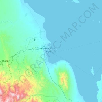
Name: Green Island topographic map, elevation, terrain.
Location: Green Island, Massawa, Northen Red Sea Region, Eritrea (15.27424 39.16002 15.91424 39.80002)
Average elevation: 165 m
Minimum elevation: -1 m
Maximum elevation: 1,890 m