
Glarey topographic map
Interactive map
Click on the map to display elevation.
About this map
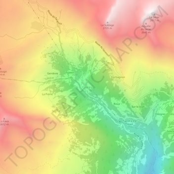
Name: Glarey topographic map, elevation, terrain.
Location: Glarey, Savièse, Sion, Wallis, 1965, Switzerland (46.28937 7.28729 46.32937 7.32729)
Average elevation: 1,988 m
Minimum elevation: 1,110 m
Maximum elevation: 2,787 m
Other topographic maps
Click on a map to view its topography, its elevation and its terrain.
Glacier de Tsanfleuron
Switzerland > Wallis > Sion > Savièse
Glacier de Tsanfleuron, Savièse, Sion, Wallis, 1965, Switzerland
Average elevation: 2,718 m
Crête-à-l'Oeil
Switzerland > Wallis > Sion > Sion > Les Agettes
Crête-à-l'Oeil, Les Agettes, Sion, Wallis, 1992, Switzerland
Average elevation: 953 m