
Frankfort topographic map
Interactive map
Click on the map to display elevation.
About this map
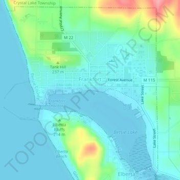
Name: Frankfort topographic map, elevation, terrain.
Location: Frankfort, Benzie County, Michigan, United States (44.61949 -86.25165 44.64454 -86.21990)
Average elevation: 194 m
Minimum elevation: 174 m
Maximum elevation: 273 m
Other topographic maps
Click on a map to view its topography, its elevation and its terrain.