
Kawhia topographic map
Interactive map
Click on the map to display elevation.
About this map
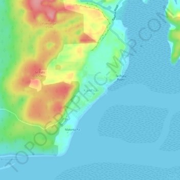
Name: Kawhia topographic map, elevation, terrain.
Location: Kawhia, Otorohanga District, Waikato, 3843, New Zealand (-38.08511 174.79827 -38.04511 174.83827)
Average elevation: 26 m
Minimum elevation: 0 m
Maximum elevation: 107 m
Other topographic maps
Click on a map to view its topography, its elevation and its terrain.
Tihiroa
New Zealand > Waikato > Otorohanga District
Tihiroa, Otorohanga District, Waikato, New Zealand
Average elevation: 88 m
Ōparau River
New Zealand > Waikato > Otorohanga District
Ōparau River, Otorohanga District, Waikato, New Zealand
Average elevation: 138 m
Waikeria
New Zealand > Waikato > Otorohanga District
Waikeria, Otorohanga District, Waikato, 3873, New Zealand
Average elevation: 66 m