
Pachiè topographic map
Interactive map
Click on the map to display elevation.
About this map
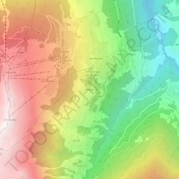
Name: Pachiè topographic map, elevation, terrain.
Location: Pachiè, Prolin, Hérémence, Ering, Wallis, 1987, Schweiz (46.15283 7.37406 46.19283 7.41406)
Average elevation: 1,522 m
Minimum elevation: 651 m
Maximum elevation: 2,448 m