
Sankt Radegund bei Graz topographic map
Interactive map
Click on the map to display elevation.
About this map
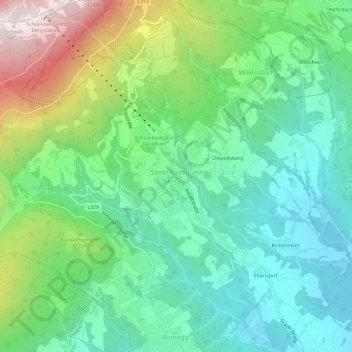
Name: Sankt Radegund bei Graz topographic map, elevation, terrain.
Average elevation: 777 m
Minimum elevation: 488 m
Maximum elevation: 1,448 m
Other topographic maps
Click on a map to view its topography, its elevation and its terrain.
Schöckl
Österreich > Steiermark > Bezirk Graz-Umgebung > St. Radegund
Schöckl, St. Radegund, Bezirk Graz-Umgebung, Steiermark, 8061, Österreich
Average elevation: 1,136 m