
达木斯乡 topographic map
Interactive map
Click on the map to display elevation.
About this map
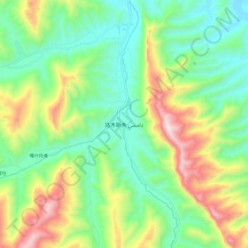
Name: 达木斯乡 topographic map, elevation, terrain.
Location: 达木斯乡, 莎车县, 喀什地区, 新疆维吾尔自治区, 中国 (37.71683 76.56630 37.79683 76.64630)
Average elevation: 2,049 m
Minimum elevation: 1,704 m
Maximum elevation: 2,724 m