
Şamaxı topographic map
Interactive map
Click on the map to display elevation.
Şamaxı
Shamakhi is located in the central part of Shirvan, at an altitude of about 749 m (2,457 ft) above sea level, in a favorable geographical position. In the south of Shamakhi flows to Zongalavay, and in the east Pirsaatchay. The city is surrounded by Binasli, Gushhan from the north, Pirdiraki, and Maiden Tower-Georgia from north-west and Meysari Mountains from the west. These mountains can be considered as the city's natural defense fortifications. There are many springs that provide urban population and people of surrounding villages with drinking water because of located at the slopes of the Caucasus Mountains.
About this map
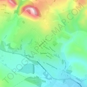
Name: Şamaxı topographic map, elevation, terrain.
Location: Şamaxı, Shamakhi District, Mountainous Shirvan, Azerbaijan (40.61684 48.61382 40.66020 48.65920)
Average elevation: 723 m
Minimum elevation: 580 m
Maximum elevation: 1,041 m
Other topographic maps
Click on a map to view its topography, its elevation and its terrain.