Geolocate

Llanrhos topographic map

Click on the map to display elevation.

About this map
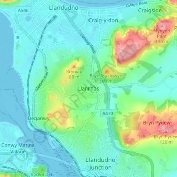
Name: Llanrhos topographic map, elevation, terrain.

Location: Llanrhos, Conwy, Wales, LL30 1SL, United Kingdom (53.28410 -3.83500 53.32410 -3.79500)

Average elevation: 29 m

Minimum elevation: 0 m

Maximum elevation: 128 m

Conwy trails, hiking, mountain biking, running and outdoor activities

Gear up for your next adventure:

🥼Base Layers - Thermal base layers for temperature regulation
🔋Power Banks - Portable chargers for long outdoor trips
🧊Insulated Flasks - Keeps drinks hot or cold during hikes
🎒Backpack Rain Covers - Universal waterproof covers to protect your gear from downpours
🍲Portable Camping Stoves - Fast-boiling stoves for hot meals on remote topographic survey trips

As an Amazon Associate, this site earns from qualifying purchases at no extra cost to you.