
Tsahir topographic map
Interactive map
Click on the map to display elevation.
About this map
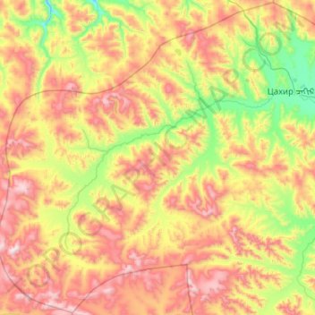
Name: Tsahir topographic map, elevation, terrain.
Location: Tsahir, Arkhangai, Mongolia (47.61479 98.17339 48.29619 99.20426)
Average elevation: 2,585 m
Minimum elevation: 2,049 m
Maximum elevation: 3,452 m
Other topographic maps
Click on a map to view its topography, its elevation and its terrain.