
Cantón Golfito topographic map
Interactive map
Click on the map to display elevation.
About this map
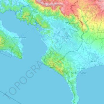
Name: Cantón Golfito topographic map, elevation, terrain.
Location: Cantón Golfito, Provincia Puntarenas, Costa Rica (8.04052 -83.33564 8.81433 -82.88576)
Average elevation: 155 m
Minimum elevation: -1 m
Maximum elevation: 1,684 m
Golfito has an area of 1,753.96 km² and a mean elevation of 24 metres.
Other topographic maps
Click on a map to view its topography, its elevation and its terrain.
Puerto Jiménez
Costa Rica > Cantón Golfito > Puerto Jiménez
Puerto Jiménez, Cantón Golfito, Provincia Puntarenas, 60702, Costa Rica
Average elevation: 68 m