
Kasunga topographic map
Interactive map
Click on the map to display elevation.
About this map
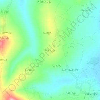
Name: Kasunga topographic map, elevation, terrain.
Location: Kasunga, Kalungu, Central Region, Uganda (-0.12690 31.83110 -0.08690 31.87110)
Average elevation: 1,202 m
Minimum elevation: 1,159 m
Maximum elevation: 1,303 m