
Thank you for supporting this site ❤️
Make a donation
Make a donation
Gear up for your next adventure:
As an Amazon Associate, this site earns from qualifying purchases at no extra cost to you.
Llanrhos topographic map
Click on the map to display elevation.
Thank you for supporting this site ❤️
Make a donation
Make a donation
Gear up for your next adventure:
As an Amazon Associate, this site earns from qualifying purchases at no extra cost to you.
About this map
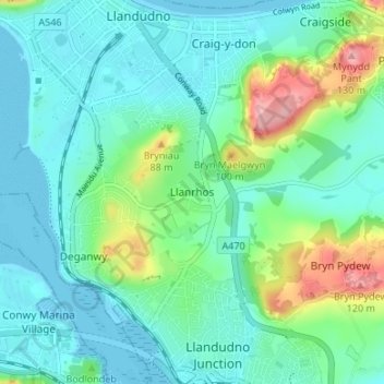
Name: Llanrhos topographic map, elevation, terrain.
Location: Llanrhos, Conwy, Wales, LL30 1SL, United Kingdom (53.28410 -3.83500 53.32410 -3.79500)
Average elevation: 29 m
Minimum elevation: 0 m
Maximum elevation: 128 m
Conwy trails, hiking, mountain biking, running and outdoor activities
Thank you for supporting this site ❤️
Make a donation
Make a donation
Gear up for your next adventure:
As an Amazon Associate, this site earns from qualifying purchases at no extra cost to you.