
Eschwege topographic map
Interactive map
Click on the map to display elevation.
About this map
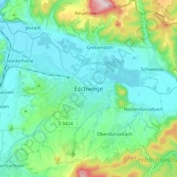
Name: Eschwege topographic map, elevation, terrain.
Location: Eschwege, Werra-Meißner-Kreis, Hessen, 37269, Deutschland (51.14687 10.01751 51.22687 10.09751)
Average elevation: 222 m
Minimum elevation: 151 m
Maximum elevation: 489 m