
Penrhiwceiber topographic map
Interactive map
Click on the map to display elevation.
About this map
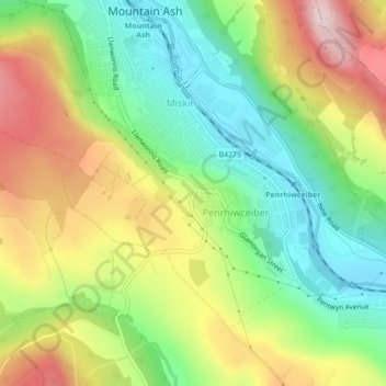
Name: Penrhiwceiber topographic map, elevation, terrain.
Location: Penrhiwceiber, Rhondda Cynon Taf, Wales, United Kingdom (51.65984 -3.38463 51.67887 -3.35487)
Average elevation: 229 m
Minimum elevation: 95 m
Maximum elevation: 410 m