
Haundorf topographic map
Interactive map
Click on the map to display elevation.
About this map
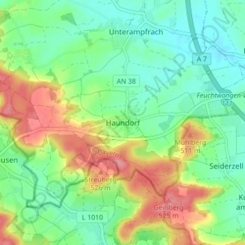
Name: Haundorf topographic map, elevation, terrain.
Location: Haundorf, Schnelldorf, Landkreis Ansbach, Bayern, Deutschland (49.14950 10.20090 49.18950 10.24090)
Average elevation: 478 m
Minimum elevation: 445 m
Maximum elevation: 534 m