
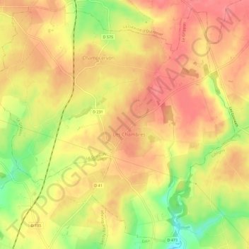
Le Grippon topographic map
Interactive map
Click on the map to display elevation.
About this map
Name: Le Grippon topographic map, elevation, terrain.
Average elevation: 114 m
Minimum elevation: 66 m
Maximum elevation: 138 m
Other topographic maps
Click on a map to view its topography, its elevation and its terrain.
Champcervon
France > Normandie > Manche > Le Grippon
Champcervon, Le Grippon, Avranches, Manche, Normandie, France métropolitaine, 50320, France
Average elevation: 114 m
Les Chambres
France > Normandie > Manche > Le Grippon
Les Chambres, Le Grippon, Avranches, Manche, Normandie, France métropolitaine, 50320, France
Average elevation: 115 m