
Taman Awam Pantai Tanjung Purun topographic map
Interactive map
Click on the map to display elevation.
About this map
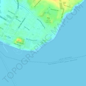
Name: Taman Awam Pantai Tanjung Purun topographic map, elevation, terrain.
Location: Taman Awam Pantai Tanjung Purun, Victoria, Labuan, Malaysia (5.27436 115.25543 5.27622 115.25784)
Average elevation: 4 m
Minimum elevation: 0 m
Maximum elevation: 27 m