
Kuwait topographic map
Click on the map to display elevation.
About this map
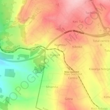
Name: Kuwait topographic map, elevation, terrain.
Location: Kuwait, Kamara ward, Kuresoi North, Nakuru, Rift Valley, Kenya (-0.18653 35.65369 -0.14653 35.69369)
Average elevation: 2,518 m
Minimum elevation: 2,403 m
Maximum elevation: 2,603 m