
Ellenboro topographic map
Interactive map
Click on the map to display elevation.
About this map
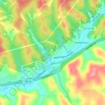
Name: Ellenboro topographic map, elevation, terrain.
Location: Ellenboro, Ritchie County, West Virginia, United States (39.25689 -81.06682 39.27972 -81.04102)
Average elevation: 280 m
Minimum elevation: 232 m
Maximum elevation: 336 m
Other topographic maps
Click on a map to view its topography, its elevation and its terrain.