
Fort Lagarde topographic map
Interactive map
Click on the map to display elevation.
About this map
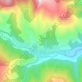
Name: Fort Lagarde topographic map, elevation, terrain.
Average elevation: 894 m
Minimum elevation: 675 m
Maximum elevation: 1,220 m
Other topographic maps
Click on a map to view its topography, its elevation and its terrain.
Prats-de-Mollo-la-Preste
France > Occitanie > Pyrénées-Orientales > Prats-de-Mollo-la-Preste > Prats-de-Mollo-la-Preste
Prats-de-Mollo-la-Preste, Céret, Pyrénées-Orientales, Occitanie, France métropolitaine, 66230, France
Average elevation: 957 m