
Serra da Estrela topographic map
Interactive map
Click on the map to display elevation.
About this map
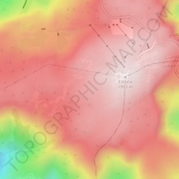
Name: Serra da Estrela topographic map, elevation, terrain.
Location: Serra da Estrela, Seia, Guarda, Portugal (40.31995 -7.62005 40.32005 -7.61995)
Average elevation: 1,825 m
Minimum elevation: 1,365 m
Maximum elevation: 1,993 m
Other topographic maps
Click on a map to view its topography, its elevation and its terrain.
Paranhos da Beira
Paranhos da Beira, Seia, Guarda, 6270-133, Portugal
Average elevation: 379 m