Geolocate

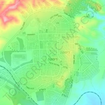
Dimona topographic map

Click on the map to display elevation.

Dimona

Dimona is located in the Negev Desert. The city stands at an elevation of around 550–600 metres (1,800–1,970 ft) above sea level.

Wikipedia (CC-BY-SA 3.0)

About this map

Name: Dimona topographic map, elevation, terrain.

Location: Dimona, Beersheba Subdistrict, South District, Israel (31.05417 35.01951 31.08754 35.05418)

Average elevation: 554 m

Minimum elevation: 488 m

Maximum elevation: 665 m

Gear up for your next adventure:

🧢Thermal Beanie Hats - Prevent heat loss from the head in windy summit conditions
🧘Folding Sit Mats - Dry and warm seat for map-reading breaks on damp ground
🧤Waterproof Overmitts - Extreme weather protection for hikers and mountaineers
🛌Insulated Sleeping Mats - Crucial thermal protection when sleeping on cold, uneven ground
🛰️Handheld GPS Devices - Reliable GPS units for hiking and outdoor navigation

As an Amazon Associate, this site earns from qualifying purchases at no extra cost to you.