Geolocate

Ingold topographic map

Click on the map to display elevation.

About this map

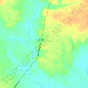
Name: Ingold topographic map, elevation, terrain.

Location: Ingold, Sampson County, North Carolina, United States (34.80206 -78.36704 34.86326 -78.32842)

Average elevation: 26 m

Minimum elevation: 12 m

Maximum elevation: 47 m

Gear up for your next adventure:

🔥Reusable Hand Warmers - Maintain dexterity in your fingers for precise map handling
🧢Thermal Beanie Hats - Prevent heat loss from the head in windy summit conditions
🧤Waterproof Overmitts - Extreme weather protection for hikers and mountaineers
🪢Paracord - Multi-purpose cord for camping and survival
🐕Hiking Dog Harnesses - Rugged harnesses for taking your companion on mountain trails

As an Amazon Associate, this site earns from qualifying purchases at no extra cost to you.