Geolocate

Withybrook CP topographic map

Click on the map to display elevation.

About this map

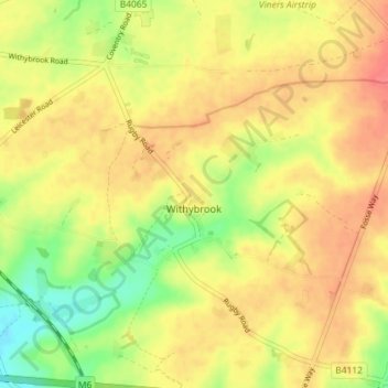
Name: Withybrook CP topographic map, elevation, terrain.

Location: Withybrook CP, Rugby, Warwickshire, England, United Kingdom (52.44227 -1.39100 52.47352 -1.31900)

Average elevation: 115 m

Minimum elevation: 81 m

Maximum elevation: 138 m

Warwickshire trails, hiking, mountain biking, running and outdoor activities

Other topographic maps

Click on a map to view its topography, its elevation and its terrain.

Draycote Water

United Kingdom > England > Warwickshire > Rugby > Draycote

Average elevation: 92 m

Newton

United Kingdom > England > Warwickshire > Rugby

Average elevation: 114 m

Newbold on Avon

United Kingdom > England > Warwickshire > Rugby

Average elevation: 98 m

Bilton

United Kingdom > England > Warwickshire > Rugby

Average elevation: 111 m

Draycote

United Kingdom > England > Warwickshire > Rugby

Average elevation: 94 m

Newton

United Kingdom > England > Warwickshire > Rugby

Average elevation: 114 m

Bramcote

United Kingdom > England > Warwickshire > Rugby

Average elevation: 105 m

Barnacle

United Kingdom > England > Warwickshire > Rugby > Barnacle

Average elevation: 102 m

Gear up for your next adventure:

🔋Power Banks - Portable chargers for long outdoor trips
🧦Hiking Socks - Breathable socks designed to prevent blisters on long walks
🔥Emergency Fire Starters - Reliable ignition tools for survival situations in damp conditions
📱Rugged Phone Cases - Heavy-duty protection for smartphones used as secondary GPS tools
🔋Lithium AA Batteries - Long-lasting power that performs well in cold mountain weather

As an Amazon Associate, this site earns from qualifying purchases at no extra cost to you.