
Kołobrzeg topographic map
Interactive map
Click on the map to display elevation.
About this map
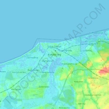
Name: Kołobrzeg topographic map, elevation, terrain.
Average elevation: 5 m
Minimum elevation: -3 m
Maximum elevation: 43 m
Other topographic maps
Click on a map to view its topography, its elevation and its terrain.
Rzemieślnicza
Poland > West Pomeranian Voivodeship > Colberg County > Kołobrzeg
Average elevation: 9 m