
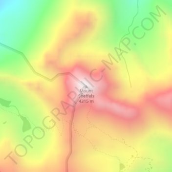
Mount Sneffels topographic map
Interactive map
Click on the map to display elevation.
About this map
Name: Mount Sneffels topographic map, elevation, terrain.
Location: Mount Sneffels, Ouray County, Colorado, United States (38.00374 -107.79232 38.00384 -107.79222)
Average elevation: 3,733 m
Minimum elevation: 3,099 m
Maximum elevation: 4,276 m
Other topographic maps
Click on a map to view its topography, its elevation and its terrain.
Ridgway
United States > Colorado > Ouray County
Ridgway is situated in the Uncompahgre Valley at an elevation of 6,985 feet (2,129 m). The town is located on the San Juan Skyway, cradled in the heart of some of the most photographed mountains in the world. The nearby San Juan Mountain Range has 14 of Colorado's 53 peaks over 14,000 feet. Among them, 14,150…
Average elevation: 2,173 m