
Oberpullendorf/Felsőpulya topographic map
Interactive map
Click on the map to display elevation.
About this map
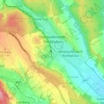
Name: Oberpullendorf/Felsőpulya topographic map, elevation, terrain.
Average elevation: 276 m
Minimum elevation: 227 m
Maximum elevation: 352 m
Other topographic maps
Click on a map to view its topography, its elevation and its terrain.
Lockenhaus
Austria > Burgenland > Bezirk Oberpullendorf
Lockenhaus, Bezirk Oberpullendorf, Burgenland, 7442, Austria
Average elevation: 492 m