
Belvás topographic map
Interactive map
Click on the map to display elevation.
About this map
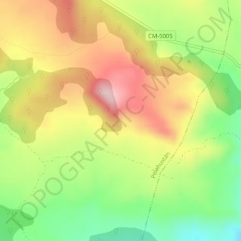
Name: Belvás topographic map, elevation, terrain.
Location: Belvás, Pelahustán, Toledo, Castilië-La Mancha, 45918, Spanje (40.15541 -4.57629 40.17541 -4.55629)
Average elevation: 644 m
Minimum elevation: 505 m
Maximum elevation: 786 m