
Seatown topographic map
Interactive map
Click on the map to display elevation.
About this map
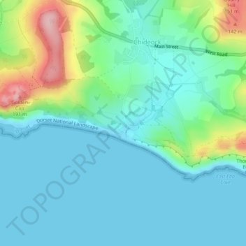
Name: Seatown topographic map, elevation, terrain.
Location: Seatown, Chideock, Dorset, England, United Kingdom (50.72220 -2.82560 50.72472 -2.82249)
Average elevation: 39 m
Minimum elevation: 0 m
Maximum elevation: 175 m