Geolocate

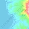
Ditucalan topographic map

Click on the map to display elevation.

About this map

Name: Ditucalan topographic map, elevation, terrain.

Location: Ditucalan, Iligan, Northern Mindanao, 9201, Philippines (8.15603 124.17277 8.19603 124.21277)

Average elevation: 162 m

Minimum elevation: 0 m

Maximum elevation: 326 m

Other topographic maps

Click on a map to view its topography, its elevation and its terrain.
Iligan City Wet Park

Philippines > Iligan

Average elevation: 17 m

Kiwalan

Philippines > Iligan

Average elevation: 74 m

Mandulog River

Philippines > Iligan > San Roque

Average elevation: 79 m

Iponan River

Philippines > Iligan

Average elevation: 563 m

Bayug River

Philippines > Iligan > Lanipao

Average elevation: 154 m

Rogongon

Philippines > Iligan

Average elevation: 587 m

Gear up for your next adventure:

🕶️Glacier Goggles - Maximum protection for high-altitude snow topography
🧦Merino Wool Hiking Socks - Moisture-wicking socks to prevent blisters during long mountain walks
🍳Camping Stoves - Compact stoves for outdoor cooking
🧥Softshell Jackets - Breathable jackets for active outdoor use
🥤Collapsible Water Bottles - Save space in your rucksack as you consume your water

As an Amazon Associate, this site earns from qualifying purchases at no extra cost to you.