
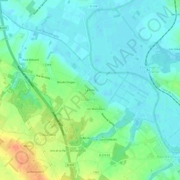
La Prée topographic map
Interactive map
Click on the map to display elevation.
About this map
Name: La Prée topographic map, elevation, terrain.
Average elevation: 13 m
Minimum elevation: 0 m
Maximum elevation: 42 m
Other topographic maps
Click on a map to view its topography, its elevation and its terrain.
Bel Air
France > Nouvelle-Aquitaine > Charente-Maritime > Crazannes
Bel Air, Crazannes, Saintes, Charente-Maritime, Nouvelle-Aquitaine, France métropolitaine, 17350, France
Average elevation: 21 m
Les Monceaux
France > Nouvelle-Aquitaine > Charente-Maritime > Crazannes
Les Monceaux, Crazannes, Saintes, Charente-Maritime, Nouvelle-Aquitaine, France métropolitaine, 17350, France
Average elevation: 15 m