Geolocate

Thattekad topographic map

Click on the map to display elevation.

About this map

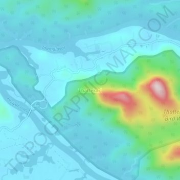
Name: Thattekad topographic map, elevation, terrain.

Location: Thattekad, Kothamangalam, Ernakulam, Kerala, 686681, India (10.11334 76.68002 10.15334 76.72002)

Average elevation: 101 m

Minimum elevation: 30 m

Maximum elevation: 509 m

Other topographic maps

Click on a map to view its topography, its elevation and its terrain.

Pooyamkutty

India > Kerala > Kothamangalam

Average elevation: 129 m

Gear up for your next adventure:

📻Hand-Crank Emergency Radios - Stay updated on weather warnings in remote areas
🧥Packable Down Jackets - Lightweight warmth that compresses small in your bag
🧦Merino Wool Hiking Socks - Moisture-wicking socks to prevent blisters during long mountain walks
🖼️Topographic Map Art - Decorative 3D-effect posters of famous UK peaks and regions
📢Survival Whistles - Essential safety gear for signaling for help in mountain fog

As an Amazon Associate, this site earns from qualifying purchases at no extra cost to you.