
Thank you for supporting this site ❤️
Make a donation
Make a donation
Gear up for your next adventure:
As an Amazon Associate, this site earns from qualifying purchases at no extra cost to you.
Pozacas topographic map
Click on the map to display elevation.
Thank you for supporting this site ❤️
Make a donation
Make a donation
Gear up for your next adventure:
As an Amazon Associate, this site earns from qualifying purchases at no extra cost to you.
About this map
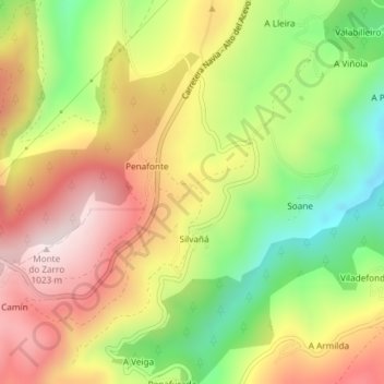
Name: Pozacas topographic map, elevation, terrain.
Location: Pozacas, Silvañá, Grandas de Salime, Asturias, 33739, Spain (43.15119 -6.94082 43.17119 -6.92082)
Average elevation: 758 m
Minimum elevation: 484 m
Maximum elevation: 1,020 m
Thank you for supporting this site ❤️
Make a donation
Make a donation
Gear up for your next adventure:
As an Amazon Associate, this site earns from qualifying purchases at no extra cost to you.