
Thank you for supporting this site ❤️
Make a donation
Make a donation
Gear up for your next adventure:
As an Amazon Associate, this site earns from qualifying purchases at no extra cost to you.
Huascaran topographic map
Click on the map to display elevation.
Thank you for supporting this site ❤️
Make a donation
Make a donation
Gear up for your next adventure:
As an Amazon Associate, this site earns from qualifying purchases at no extra cost to you.
About this map
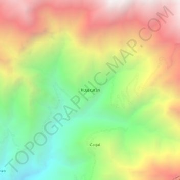
Name: Huascaran topographic map, elevation, terrain.
Location: Huascaran, Quillo, Yungay, Áncash, Perú (-9.42659 -78.00661 -9.38659 -77.96661)
Average elevation: 2,528 m
Minimum elevation: 1,536 m
Maximum elevation: 3,630 m
Thank you for supporting this site ❤️
Make a donation
Make a donation
Gear up for your next adventure:
As an Amazon Associate, this site earns from qualifying purchases at no extra cost to you.