
Château de Vaugoubert topographic map
Interactive map
Click on the map to display elevation.
About this map
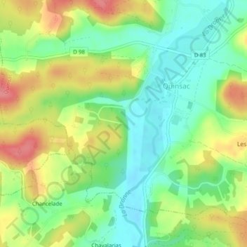
Name: Château de Vaugoubert topographic map, elevation, terrain.
Average elevation: 147 m
Minimum elevation: 112 m
Maximum elevation: 194 m
Other topographic maps
Click on a map to view its topography, its elevation and its terrain.
Chavalarias
France > Nouvelle-Aquitaine > Champagnac-de-Belair > Chavalarias
Chavalarias, Champagnac-de-Belair, Nontron, Dordogne, Nouvelle-Aquitaine, France métropolitaine, 24530, France
Average elevation: 151 m