
Massawa topographic map
Interactive map
Click on the map to display elevation.
About this map
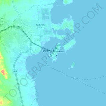
Name: Massawa topographic map, elevation, terrain.
Location: Massawa, Northen Red Sea Region, Eritrea (15.56318 39.42370 15.64318 39.50370)
Average elevation: 5 m
Minimum elevation: -1 m
Maximum elevation: 91 m
Other topographic maps
Click on a map to view its topography, its elevation and its terrain.