
Thank you for supporting this site ❤️
Make a donation
Make a donation
Gear up for your next adventure:
As an Amazon Associate, this site earns from qualifying purchases at no extra cost to you.
Marcella topographic map
Click on the map to display elevation.
Thank you for supporting this site ❤️
Make a donation
Make a donation
Gear up for your next adventure:
As an Amazon Associate, this site earns from qualifying purchases at no extra cost to you.
About this map
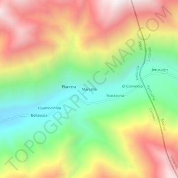
Name: Marcella topographic map, elevation, terrain.
Location: Marcella, Jaquí, Province of Caravelí, Arequipa, Peru (-15.44230 -74.35749 -15.40230 -74.31749)
Average elevation: 1,343 m
Minimum elevation: 708 m
Maximum elevation: 2,085 m
Thank you for supporting this site ❤️
Make a donation
Make a donation
Gear up for your next adventure:
As an Amazon Associate, this site earns from qualifying purchases at no extra cost to you.