Geolocate

Camrose topographic map

Click on the map to display elevation.

About this map

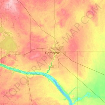
Name: Camrose topographic map, elevation, terrain.

Location: Camrose, Alberta, T4V 4J7, Canada (52.85313 -113.00058 53.17313 -112.68058)

Average elevation: 740 m

Minimum elevation: 684 m

Maximum elevation: 790 m

Gear up for your next adventure:

🧼Biodegradable Soap - Leave-no-trace hygiene for multi-day mountain treks
🎒Hiking Backpacks - Comfortable backpacks for day hikes and multi-day treks
👟Men's Trail Running Shoes - Lightweight grip for fast movement over topographic contours
🐕Hiking Dog Harnesses - Rugged harnesses for taking your companion on mountain trails
🔦Keychain LED Torches - Emergency backup light for finding gear in your pack

As an Amazon Associate, this site earns from qualifying purchases at no extra cost to you.