
Gwyddelwern topographic map
Interactive map
Click on the map to display elevation.
About this map
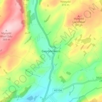
Name: Gwyddelwern topographic map, elevation, terrain.
Location: Gwyddelwern, Denbighshire, Wales, LL21 9DG, United Kingdom (52.99042 -3.40159 53.03042 -3.36159)
Average elevation: 249 m
Minimum elevation: 149 m
Maximum elevation: 386 m
Denbighshire trails, hiking, mountain biking, running and outdoor activities
Other topographic maps
Click on a map to view its topography, its elevation and its terrain.
Coed Rhedyn-coch
United Kingdom > Wales > Denbighshire > St Asaph > Marian Cwm
Average elevation: 196 m