

Palm Desert topographic map
Interactive map
Click on the map to display elevation.
Palm Desert
The elevation (at City Hall) is 224 feet (68 m) above sea level. Elevations vary from the lower northern half once covered in sand dunes to the upper slope southern cove (300–900 feet or 91–274 metres) all the way to the ridgeline at 1,000 feet (300 m). Palm Desert is in the Coachella Valley, the northwestern extension of the Sonoran Desert.
About this map
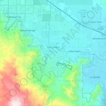
Name: Palm Desert topographic map, elevation, terrain.
Location: Palm Desert, Riverside County, California, United States (33.62705 -116.44289 33.81008 -116.26472)
Average elevation: 303 m
Minimum elevation: -2 m
Maximum elevation: 1,586 m