
Sơn La topographic map
Interactive map
Click on the map to display elevation.
About this map
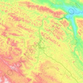
Name: Sơn La topographic map, elevation, terrain.
Location: Sơn La, Sơn La Province, Vietnam (21.24458 103.80298 21.44167 104.02903)
Average elevation: 717 m
Minimum elevation: 144 m
Maximum elevation: 1,322 m
Other topographic maps
Click on a map to view its topography, its elevation and its terrain.