
Thank you for supporting this site ❤️
Make a donation
Make a donation
Gear up for your next adventure:
As an Amazon Associate, this site earns from qualifying purchases at no extra cost to you.
Stratford topographic map
Click on the map to display elevation.
Thank you for supporting this site ❤️
Make a donation
Make a donation
Gear up for your next adventure:
As an Amazon Associate, this site earns from qualifying purchases at no extra cost to you.
About this map
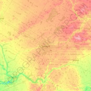
Name: Stratford topographic map, elevation, terrain.
Location: Stratford, Southwestern Ontario, Ontario, N5A 3K2, Canada (43.21009 -81.14180 43.53009 -80.82180)
Average elevation: 356 m
Minimum elevation: 280 m
Maximum elevation: 420 m
Thank you for supporting this site ❤️
Make a donation
Make a donation
Gear up for your next adventure:
As an Amazon Associate, this site earns from qualifying purchases at no extra cost to you.