
Tiefenbach topographic map
Interactive map
Click on the map to display elevation.
About this map
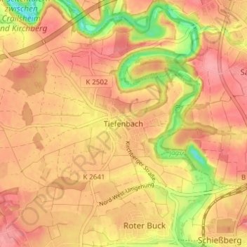
Name: Tiefenbach topographic map, elevation, terrain.
Average elevation: 424 m
Minimum elevation: 366 m
Maximum elevation: 452 m
Other topographic maps
Click on a map to view its topography, its elevation and its terrain.
Westgartshausen
Deutschland > Baden-Württemberg > Landkreis Schwäbisch Hall > Crailsheim
Westgartshausen, Crailsheim, Verwaltungsverband Crailsheim, Landkreis Schwäbisch Hall, Baden-Württemberg, Deutschland
Average elevation: 465 m