
Balgown topographic map
Interactive map
Click on the map to display elevation.
About this map
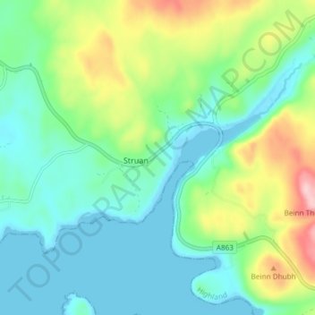
Name: Balgown topographic map, elevation, terrain.
Location: Balgown, Struan, Highland, Scotland, IV56 8FN, United Kingdom (57.33690 -6.43092 57.37690 -6.39092)
Average elevation: 58 m
Minimum elevation: 0 m
Maximum elevation: 208 m
Other topographic maps
Click on a map to view its topography, its elevation and its terrain.