
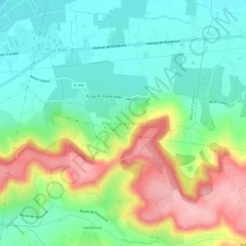
Allez et Cazeneuve topographic map
Interactive map
Click on the map to display elevation.
About this map
Name: Allez et Cazeneuve topographic map, elevation, terrain.
Average elevation: 106 m
Minimum elevation: 51 m
Maximum elevation: 204 m
Other topographic maps
Click on a map to view its topography, its elevation and its terrain.
Cazeneuve
France > Nouvelle-Aquitaine > Lot-et-Garonne > Allez-et-Cazeneuve > Cazeneuve
Cazeneuve, Allez-et-Cazeneuve, Villeneuve-sur-Lot, Lot-et-Garonne, Nouvelle-Aquitaine, France métropolitaine, 47110, France
Average elevation: 139 m
Allez
France > Nouvelle-Aquitaine > Lot-et-Garonne > Allez-et-Cazeneuve > Allez et Cazeneuve
Allez, Allez et Cazeneuve, Allez-et-Cazeneuve, Villeneuve-sur-Lot, Lot-et-Garonne, Nouvelle-Aquitaine, France métropolitaine, 47110, France
Average elevation: 101 m