Geolocate

Nomad District topographic map

Interactive map

Click on the map to display elevation.

About this map

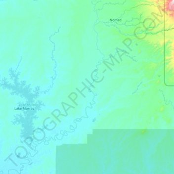
Name: Nomad District topographic map, elevation, terrain.

Location: Nomad District, Western, Southern Region, Papua New Guinea (-7.53333 141.30000 -6.13333 142.70000)

Average elevation: 85 m

Minimum elevation: 4 m

Maximum elevation: 1,845 m

Other topographic maps

Click on a map to view its topography, its elevation and its terrain.

Samari

Papua New Guinea > Western

Samari, Western, Southern Region, Papua New Guinea

Average elevation: 1 m

Tabubil

Papua New Guinea > Western

Tabubil, Western, Southern Region, Papua New Guinea

Average elevation: 591 m

Balimo

Papua New Guinea > Western

Balimo, Western, Southern Region, Papua New Guinea

Average elevation: 6 m

Biangabip

Papua New Guinea > Western > Biangabip

Biangabip, Western, Southern Region, Papua New Guinea

Average elevation: 466 m

Daru Island

Papua New Guinea > Western

Daru Island, Daru District, Western, Papua Region, Papua New Guinea

Average elevation: 5 m

Daru

Papua New Guinea > Western > Daru

Daru, Western, Papua Region, Papua New Guinea

Average elevation: 1 m

Western

Papua New Guinea > Western

Western, Papua Region, Papua New Guinea

Average elevation: 373 m