
Al Quraynah topographic map
Interactive map
Click on the map to display elevation.
About this map
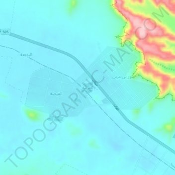
Name: Al Quraynah topographic map, elevation, terrain.
Location: Al Quraynah, Duruma, Riyadh Region, Saudi Arabia (24.44800 46.40005 24.48800 46.44005)
Average elevation: 640 m
Minimum elevation: 608 m
Maximum elevation: 816 m
Other topographic maps
Click on a map to view its topography, its elevation and its terrain.