
Zeist topographic map
Click on the map to display elevation.
About this map
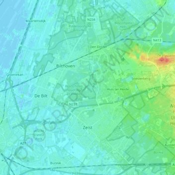
Name: Zeist topographic map, elevation, terrain.
Location: Zeist, Utrecht, Netherlands (52.05849 5.19275 52.17125 5.33262)
Average elevation: 7 m
Minimum elevation: -2 m
Maximum elevation: 50 m
Other topographic maps
Click on a map to view its topography, its elevation and its terrain.