
Caudete topographic map
Interactive map
Click on the map to display elevation.
About this map
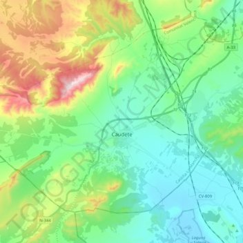
Name: Caudete topographic map, elevation, terrain.
Location: Caudete, Albacete, Castilië-La Mancha, 02660, Spanje (38.65507 -1.11967 38.77479 -0.91579)
Average elevation: 667 m
Minimum elevation: 488 m
Maximum elevation: 1,143 m